On Sunday morning after a good breakfast and lunch prepared we set off for our organised walk taking in the Manifold valley, Thor’s cave, Ecton and Wetton Hills. A 20 minute drive out of Derbyshire and into Staffordshire to the start of the walk in the delightful village of Alstonefield.
In Alstonefield we parked in one of the three free car parks and then headed to the green in front of the George Head public house.From the green we headed out west and took the track at the side of the village hall which lead to a footpath across sports fields and out onto the hillside. We followed the footpath through Hope Marsh straight across two lanes and up towards Wetton. Where the path emerges onto a lane on the outskirts of Wetton we took the first lane on the right and then turned left along the Mires.
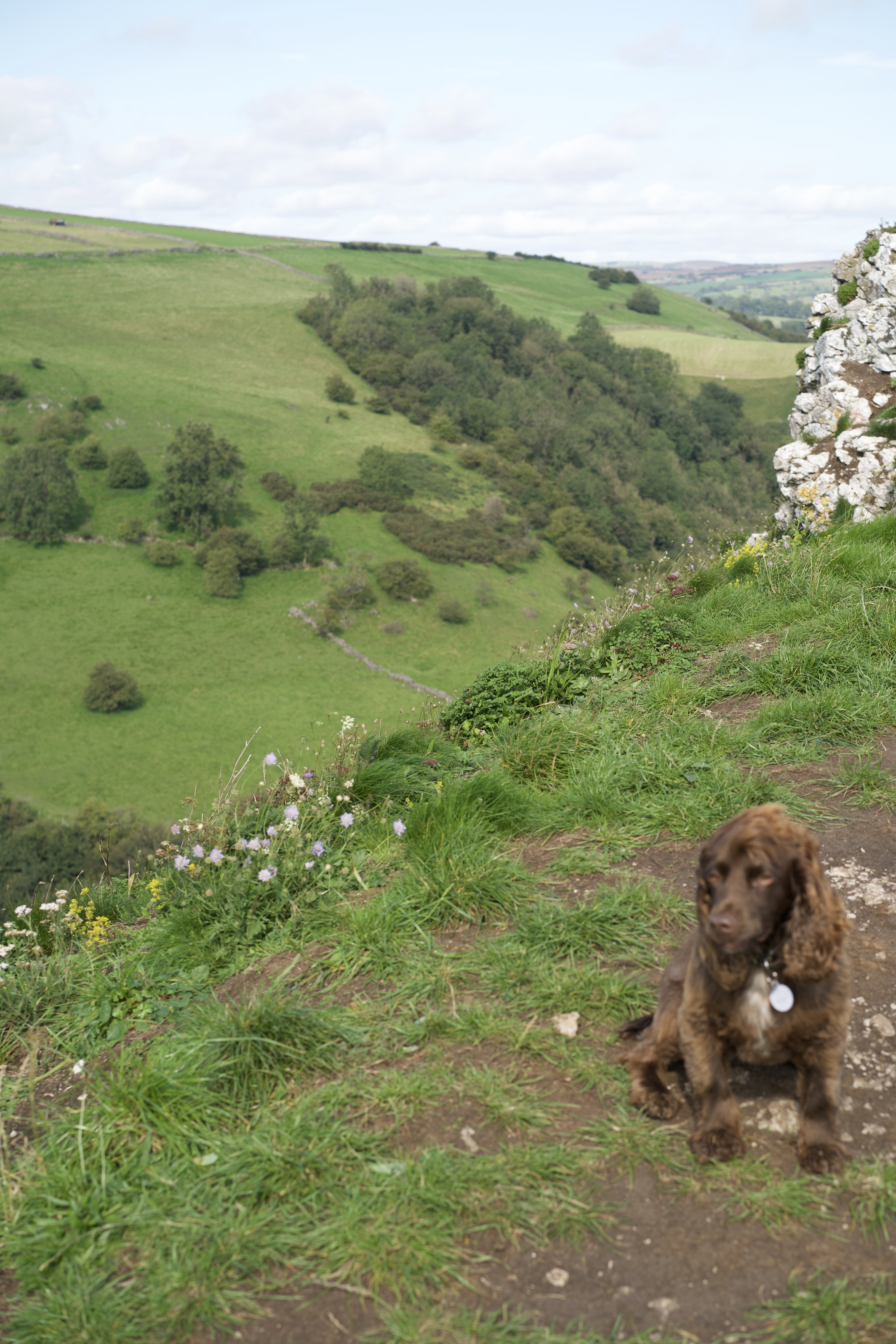
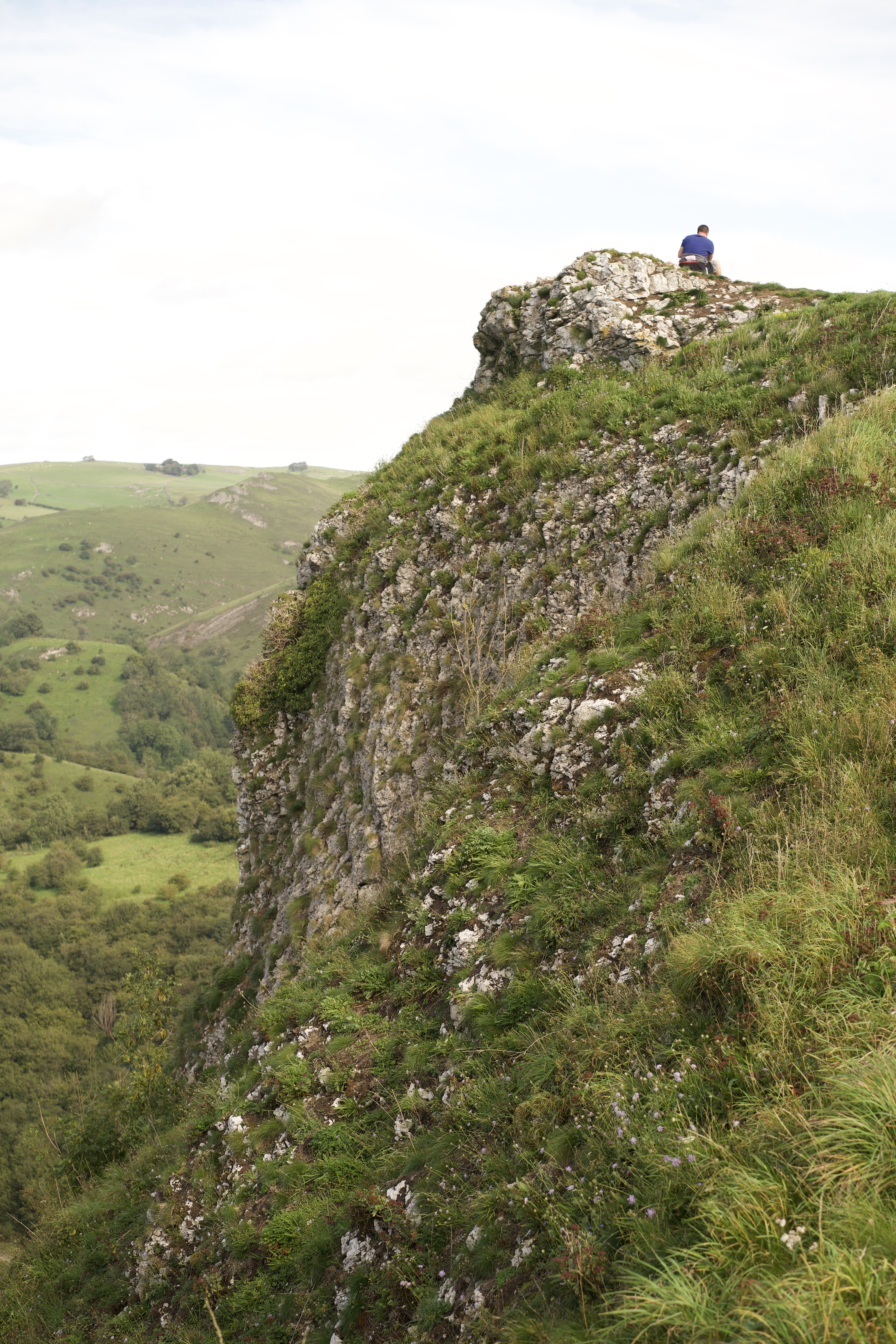
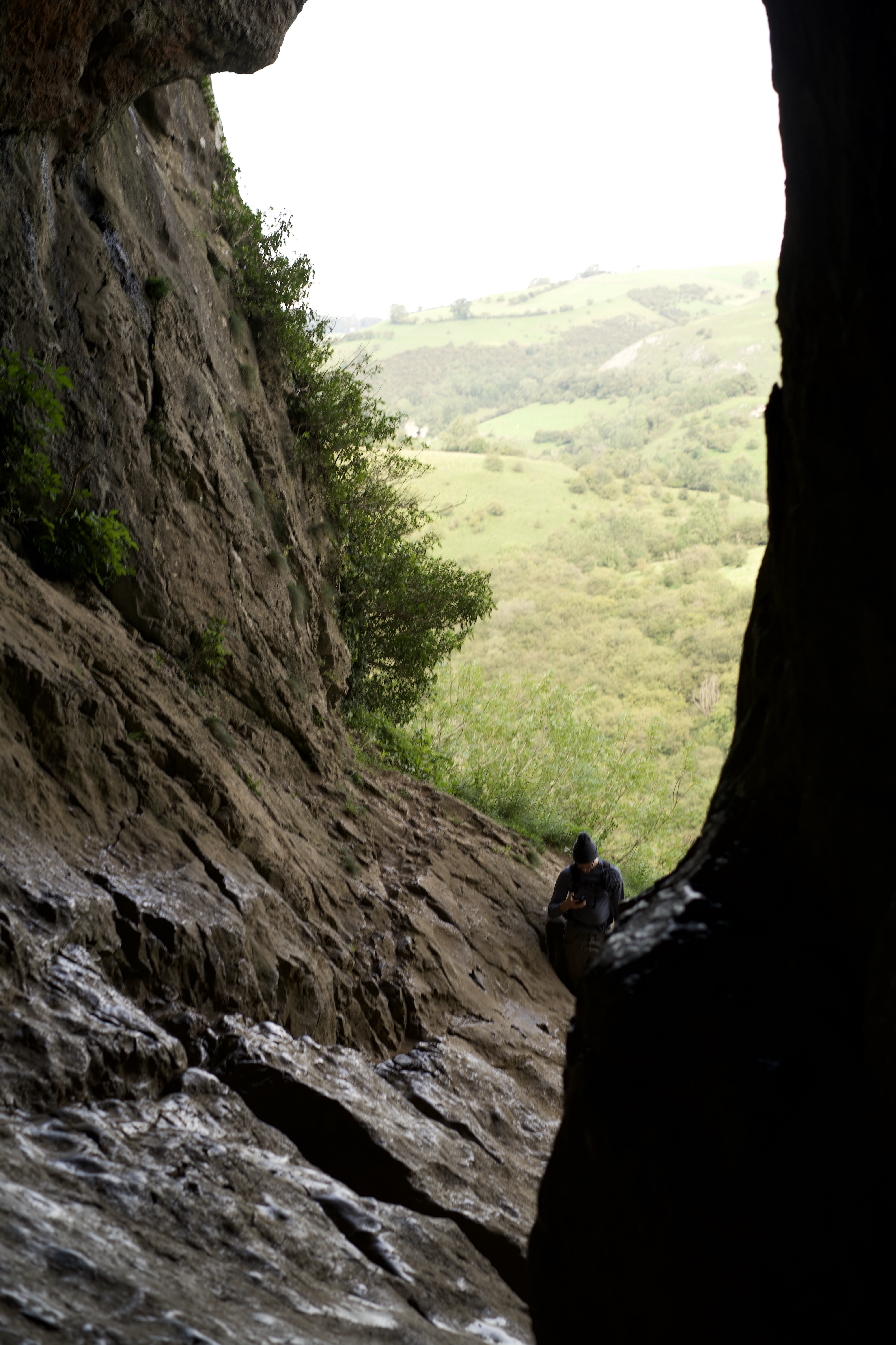
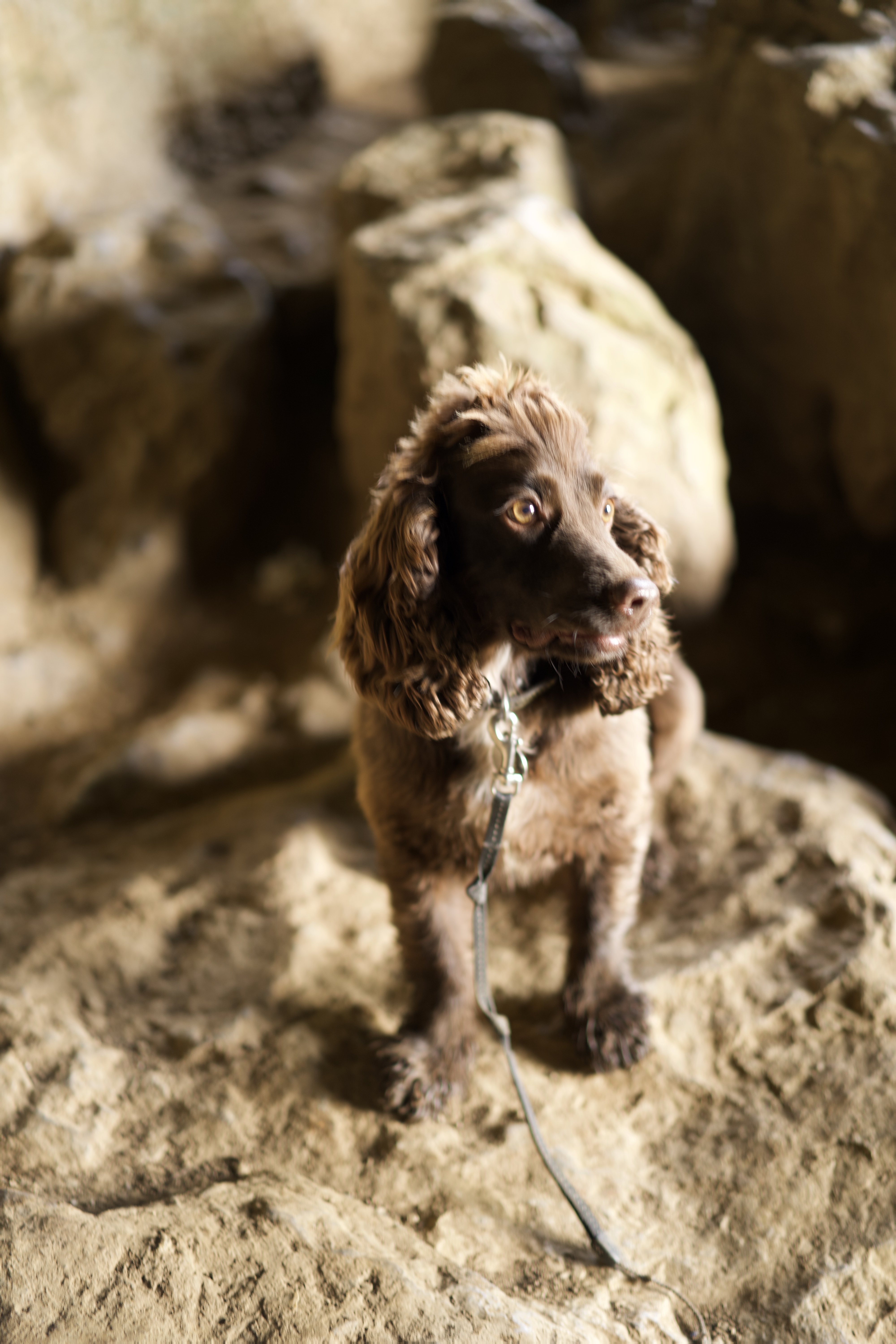
From the Mires we walked up to the centre of the village opposite the Royal Oak and through the churchyard. A cafe was situated at the rear of the churchyard where we headed out west till we found a concessionary path on the left signposted for Thor’s cave.
After exploring Thor’s cave we followed steps down to the valley floor where we turned right on the surfaced track which is a walkway and cycleway built on the track bed of a former narrow-gauge railway closed in 1934. Where the track crosses the lane we took the left fork and followed the old road. On the way to Wetton Mill we came to Dafar Bridge at the downstream end of a stretch of the Manifold where it often disappears underground. For much of the year the river flows four miles underground from “swailet holes” below Wetton Mill before emerging from “boil holes in Ilam Park.
After crossing a bridge over the river and having lunch in Wetton Mill we set off towards Swainsley turning left in front of Dale Farm. Towards the end of the gated road Swainsley Hall becomes visible through the trees.
At the end of the gated road turn right on the lane following the river valley around the foot of Ecton Hill. The old engine house becomes visible on top of Ecton Hill way on up on the hillside which was used to pump out the most productive copper mines in its day with innovative engineering and made a fortune for the Dukes of Devonshire. Rich in ores of copper with some lead and zinc, Ecton Hill was mined extensively until the productive deposits were exhausted.
The onward route turns sharp right up a track behind the former mine manager’s house. We continued around the bend as far as Apes Tor to view the rock formations contorted by unimaginable forces when continents collided.
Returning to the track we went up the path in front of a most unusual house, then turned left the kept right to follow a permissive path that loops around the hillside up to the engine house seen earlier. From here we could view the shaft cap with the lowest level of the mine over 400 metres below our feet.
We continued straight up the hillside past abandoned mine entries, through and gate then veered right to the trig point at the top of Ecton Hill. Looking north we could see how the landscape differed where the White Peak met the Dark Peak. Heading off in a southernly direction, the permissive path was unmarked but meets a right-of-way at the side of a ruined mine building. We continued straight ahead to a lane at back of Ecton, then we dropped down to a junction and turned right; at a sharp right hand bend we left the lane onto the foot of Wetton Hill. Going around the northern side of Wetton Hill, we gradually gained height. At the Eastern side of Wetton Hill, we ignored the open gateway and instead climbed a stile and across a field to a lane. Turning right on the lane then left on a path we walked past the side of Gateham Farm; following the left-hand path at the sign-posted path junction by the farm and continued across a lane and several fields followed by a pleasant stroll down the Raikes into Alstonefield and back to the car park.